Input Files
Contents
Input Files#
This defines where Geona Hyperspectral looks for input files for the boresight calibration process. Choose between:
Local Filesystem to use files mounted in the container in
/opt/geona/data. If you use local files, symlinks are used to link raw input files to the workspace.AWS S3 Bucket to browse files stored with Amazon Web Services. You will be prompted for security credentials and files will be downloaded to the workspace folder
Google Cloud Storage to browse files stored with Google Cloud. You will be prompted for security credentials and files will be downloaded to the workspace folder
For AWS and Google Cloud, data egress charges may appy depending on where Geona Hyperspectral is running in relation to the location of the cloud storage. Please check the data egress policy for your provider before proceeding as we are not liable for any data egress charges applied to your account as a result of using this software.
Required Files#
The boresight calibration process requires 2 pairs of flight lines of calibrated and geolocated processed data. One flight line can be used in both pairs meaning you need a minimum of three processed flight lines. In each case, you are asked to select the Level 1 file; all other required files are assumed to be in the same folder, these are:
<file_handle>_level1.bil<file_handle>_level1.bil.hdr<file_handle>_mapped.bil<file_handle>_mapped.bil.hdr<file_handle>_reprojected.igm<file_handle>_reprojected.igm.hdr<file_handle>_rowcol.bil<file_handle>_rowcol.bil.hdr
Flight Line Pair 1#
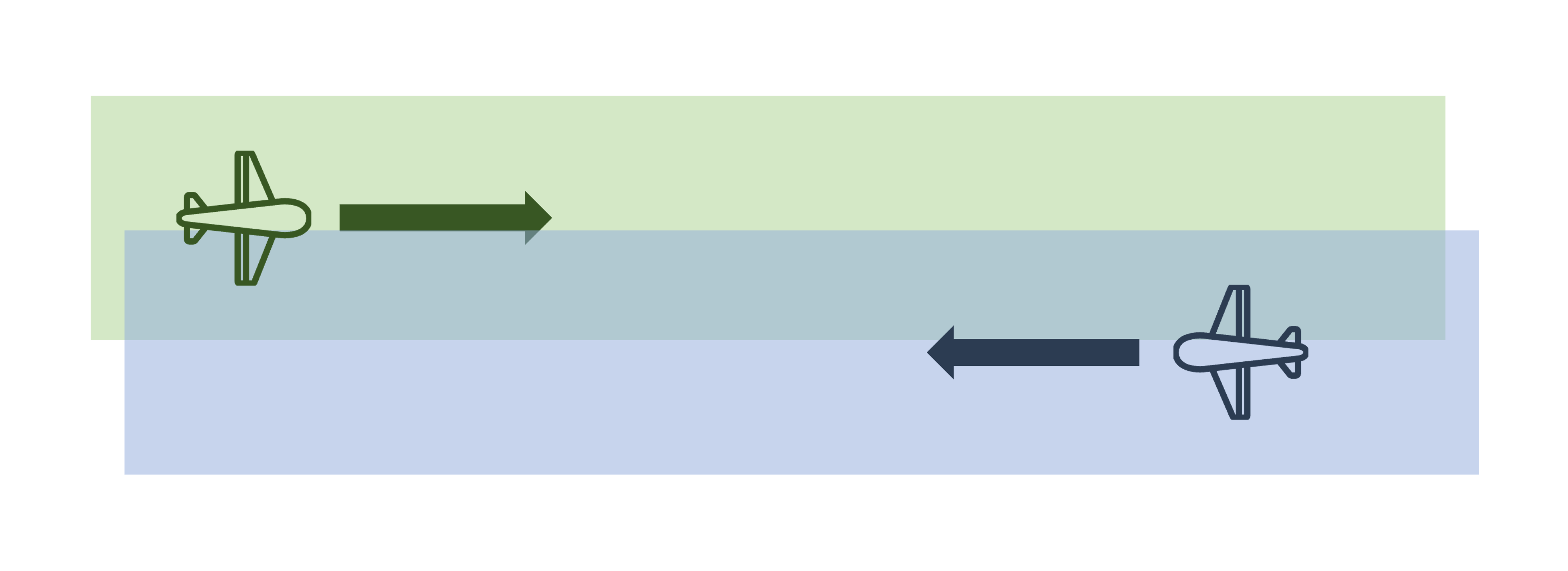
The first pair of flights should be in opposite directions with as much overlap as possible and at the same altitude. If there is insufficient overlap, the object matching algorithm will not be able to find a suitable number of common points in the data.
If there is too much difference in altitude between the two flights, offset angles cannot be reliably calculated; in this case an error is logged and the process will exit.
You are required to select the Level 1 file from the calibrated geolocated data processed where Boresight correction values are set to zero.
Flight Line Pair 2#
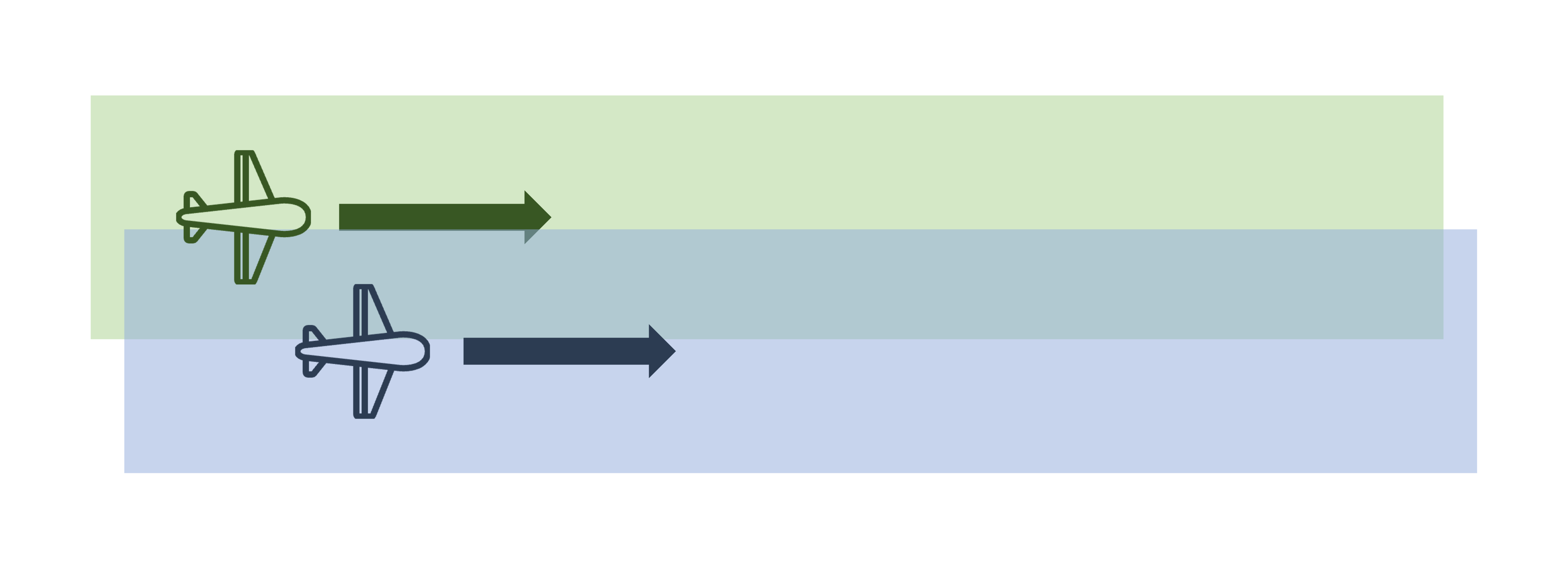
The second pair of flights should be in the same direction with as much overlap as possible and at the same altitude. If there is insufficient overlap, the object matching algorithm will not be able to find a suitable number of common points in the data.
If there is too much difference in altitude between the two flights, offset angles cannot be reliably calculated; in this case an error is logged and the process will exit.
You are required to select the Level 1 file from the calibrated geolocated data processed where Boresight correction values are set to zero.
Tie Points#
During the processing Geona Hyperspectral will automatically identify matching objects/features which are common to both flight lines in each flight line pair; this will produce the most accurate result and is the recommended method.
However, it is possible to manual identify common features. This could be useful in situations where the data do not contain
enough features with enough contrast to automatically detect enough matches of good quality. If this is the case, the user will
need to identify and record tiepoints manually. The easiest option is to use the QGIS’s georeferencing tool to match
pixels in two images and export them in the default *.points (CSV) format.
This format has the following headings:
mapX,mapY,pixelX,pixelY,enable